

Magnitude 4.3 earthquake strikes near Denpasar, Bali, Indonesia /
Tue, 23 Feb 2021, 14:29
14:29 PM | BY: EARTHQUAKEMONITOR
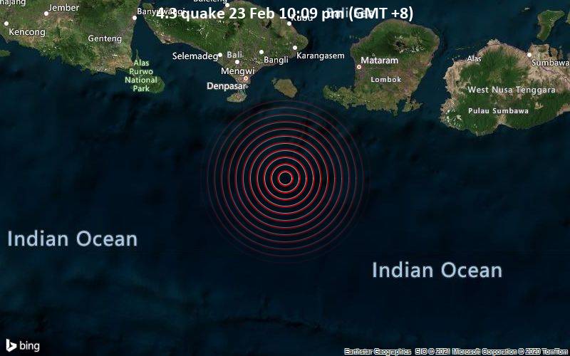
4.3 quake 23 Feb 10:09 pm (GMT +8)
A magnitude 4.3 earthquake near Denpasar, Bali, Indonesia, was reported only 12 minutes ago by Indonesia’s Meteorology, Climatology, and Geophysical Agency, considered the main national agency that monitors seismic activity in Indonesia. The earthquake occurred at a shallow depth of 28 km beneath the epicenter late at night on Tuesday 23 February 2021 at 10:09 pm local time. The exact magnitude, epicenter, and depth of the quake might be revised within the next few hours or minutes as seismologists review data and refine their calculations, or as other agencies issue their report.
Our monitoring service identified a second report from the European-Mediterranean Seismological Centre (EMSC) which listed the quake at magnitude 4.3 as well.
Towns or cities near the epicenter where the quake might have been felt as very weak shaking include Kuta (pop. 30,000) located 88 km from the epicenter, Denpasar (pop. 834,900) 93 km away, and Klungkung (pop. 27,800) 101 km away.
VolcanoDiscovery will automatically update magnitude and depth if these change and follow up if other significant news about the quake become available. If you’re in the area, please send us your experience through our reporting mechanism, either online or via our mobile app. This will help us provide more first-hand updates to anyone around the globe who wants to know more about this quake.
If you felt it, report it through our site or app right now!
Earthquake data:
I felt this quake
Date & time: 23 Feb 2021 10:09 pm (GMT +8) local time (23 Feb 2021 14:09 GMT)
Magnitude: 4.3
Depth: 28.0 km
Epicenter latitude / longitude: 9.43°S / 115.53°E ![]() (Indian Ocean, Indonesia)
(Indian Ocean, Indonesia)
Primary data source: BMKG
Previous news


Read More: Magnitude 4.3 earthquake strikes near Denpasar, Bali, Indonesia /